select language: DE-AT
DE-BE
DE-CH
DE-DE
EN-AU
EN-CA
EN-GB
EN-IN
EN-NZ
EN-US
ES-AR
ES-ES
ES-MX
FR-BE
FR-CA
FR-FR
IT-IT
JA-JP
NL-BE
NL-NL
PT-BR
ZH-CN
DE-AT
DE-BE
DE-CH
DE-DE
ES-ES
FR-BE
FR-FR
IT-IT
NL-BE
NL-NL
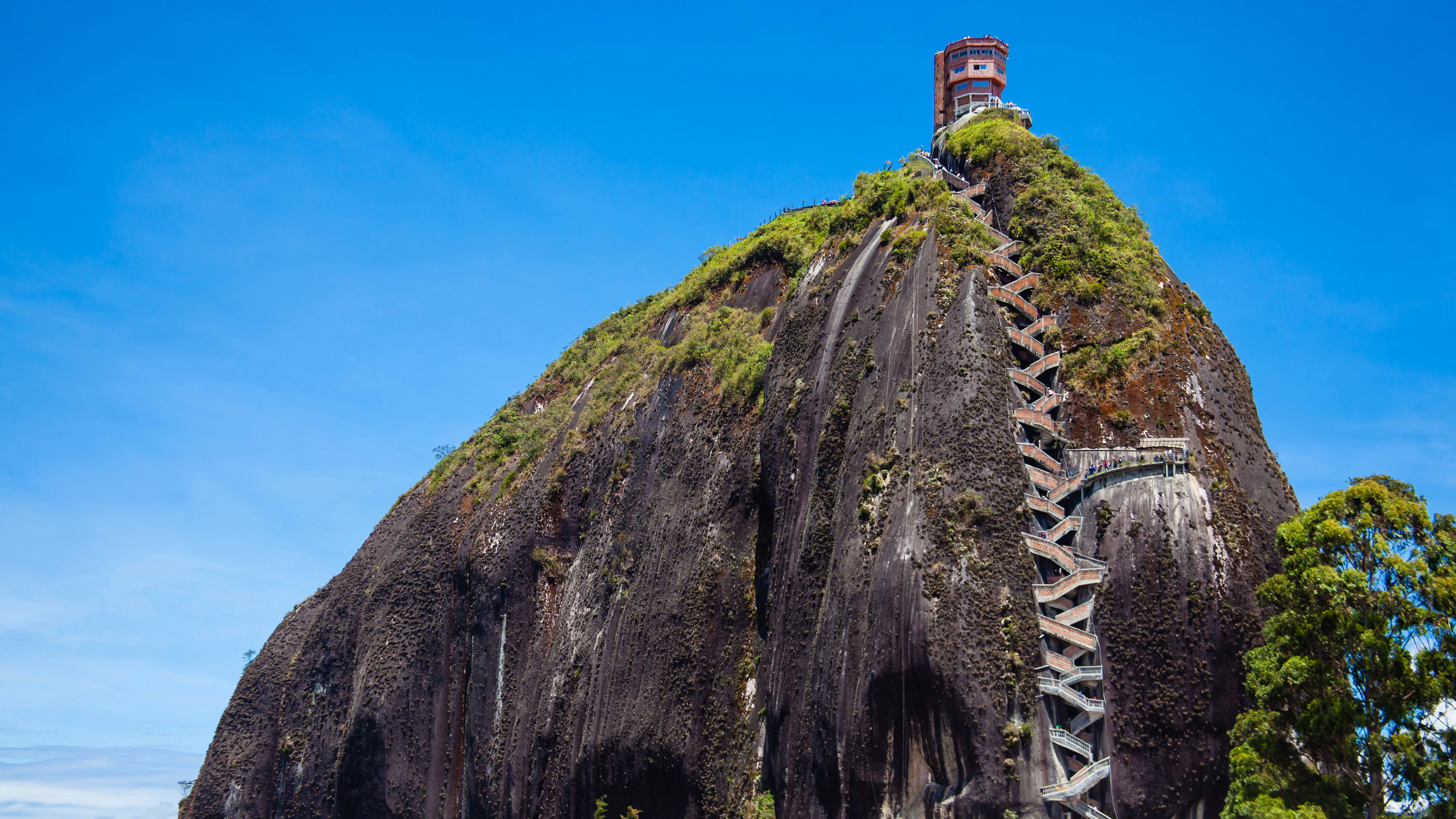
El Peñón de Guatapé, Colombia
Whose rock is it anyway?
The last century of this lone stone hulk's 65 million years has brought some changes – and that staircase running up its side like stitches on a baseball is just one of them. Visitors who climb 700-plus steps to the top of El Peñón de Guatapé are rewarded with a view over the flooded valley below, a tangle of countless inlets, straits and bays that came about in the 1970s when a hydroelectric dam was built. Forced to higher ground, the nearby towns of Guatapé and El Peñol soon developed a rocky rivalry. On the other side of the rock, a prominent graffito seeming to read "GI" remains after a Guatapé denizen attempted to brand it for his hometown – only for El Peñol residents to stop him before he finished writing the "U".
Whose rock is it anyway?
The last century of this lone stone hulk's 65 million years has brought some changes – and that staircase running up its side like stitches on a baseball is just one of them. Visitors who climb 700-plus steps to the top of El Peñón de Guatapé are rewarded with a view over the flooded valley below, a tangle of countless inlets, straits and bays that came about in the 1970s when a hydroelectric dam was built. Forced to higher ground, the nearby towns of Guatapé and El Peñol soon developed a rocky rivalry. On the other side of the rock, a prominent graffito seeming to read "GI" remains after a Guatapé denizen attempted to brand it for his hometown – only for El Peñol residents to stop him before he finished writing the "U".
© Anamaria Mejia / Shutterstock 2026-09-11 08:45:52 :